Smoky Mountains Map
A Smoky Mountains map is helpful to find your way around. Some vehicle navigation systems and GPS units may provide inaccurate information driving through the peaks and valleys of the mountains. Use a separate Smoky Mountains map for driving and hiking so that you have the most details available. Great Smoky Mountains National Park visitor centers have both types of maps available. In the winter, check for updated road closings, as Clingmans Dome Road to the observation tower is closed during the winter months, and occasionally in early spring and late fall depending on weather conditions.
Smoky Mountain Maps
Three Smoky Mountains maps that open in a new window and can be printed:
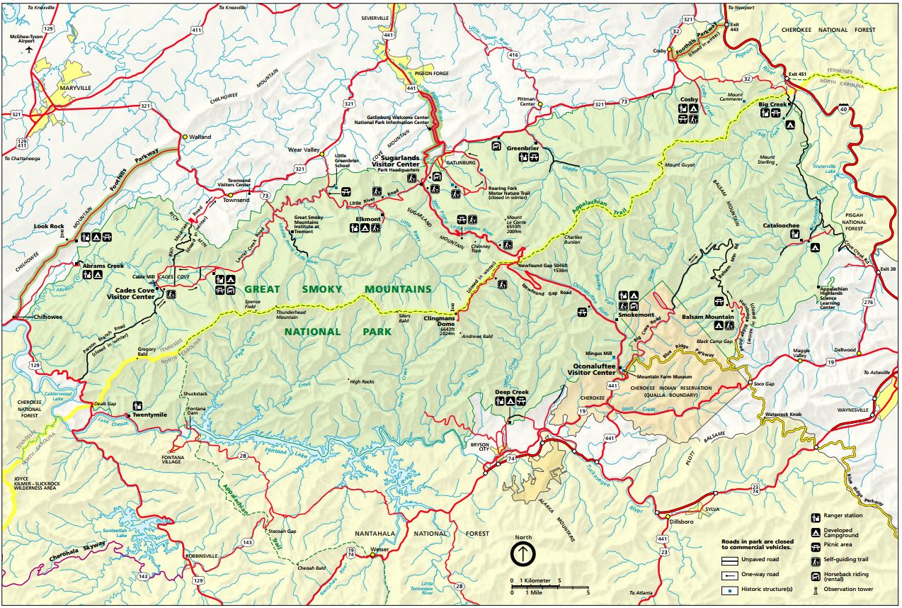
Smoky Mountains Map – Great Smoky Mountains National Park map
Map Includes:
- Park roads, visitor centers, picnic areas, campgrounds, ranger stations, and the Clingmans Dome observation tower
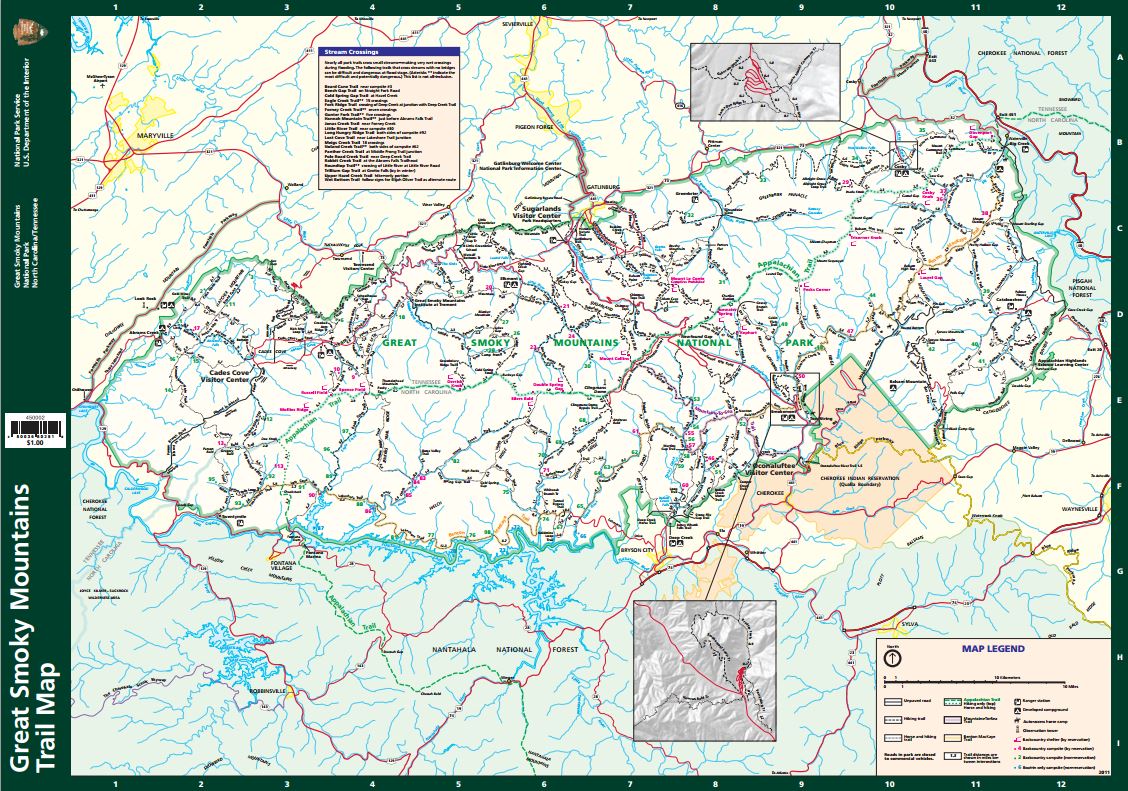
Smoky Mountains Trail Map – Hiking trails in the Great Smoky Mountains National Park
Map includes:
- Details of hiking trails, backcountry shelters and campsites, trail distances and detailed descriptions
Smoky Mountains Area Map – Are map of Smoky Mountains in Tennesse and North Carolina
Map includes:
- General overview showing location of Smoky Mountains with major highways through Chattanooga, Knoxville, Asheville, and Greenville

View Larger Map